 Last year, a JBHE post reported on research at the University of Minnesota that revealed how the construction of Interstate 35 in Minneapolis had been routed through Black neighborhoods. Now researchers at Ohio State University are examining how interstate highway construction altered the Black neighborhoods of Columbus.
After the passage of the Federal Aid Highway Act of 1956, a massive public works effort went into constructing the nation’s interstate highway system. Today the system includes more than 48,000 miles of highways. When constructing the system through urban areas, planners often chose routes that went through the poorest and predominantly Black neighborhoods. It was cheaper to obtain property in these neighborhoods and planners believed they would meet minimal resistance from residents and political leaders in these areas.
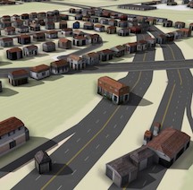
The building of the interstate highway system in Columbus split and sometimes destroyed entire neighborhoods, mostly those housing African Americans, immigrants, and other minorities. Now a team of researchers is working to digitally recreate these “ghost neighborhoods” in 3D so that people can see, and researchers can study, what was lost.
The key data being used in the project are Sanborn Fire Insurance Maps, which are hand-constructed maps of U.S. cities, including Columbus, which were created for fire insurance purposes. These maps will allow the research team to reconstruct what Columbus looked like at the building level prior to the construction of Interstate 70.
The Ghost Neighborhoods project is starting with the Hanford Village neighborhood on the east side that was split in the mid-1960s to build I-70 through the city. Early findings show that more than 100 houses were razed to build the highway and adjacent roads, many of which were owned by Black veterans of World War II.
“These highways just ripped through the middle of neighborhoods, disconnecting communities from each other and destroying homes and businesses that would never come back,” said Harvey Miller, a professor of geography at Ohio State and the leader of the Ghost Neighborhoods of Columbus project. “What we plan to do is show what these neighborhoods looked like in realistic detail before these interstates were built and learn more about what was lost.”